Phagwara Junction railway station
Appearance
(Redirected from Phagwara railway station)
Phagwara Junction | ||||||||||||||||
|---|---|---|---|---|---|---|---|---|---|---|---|---|---|---|---|---|
| Indian Railways junction station | ||||||||||||||||
| General information | ||||||||||||||||
| Location | NH 1, Prem Nagar, Phagwara, Kapurthala district, Punjab | |||||||||||||||
| Coordinates | 31°13′01″N 74°45′54″E / 31.217°N 74.765°E | |||||||||||||||
| Elevation | 245 metres (804 ft) | |||||||||||||||
| Owned by | Indian Railways | |||||||||||||||
| Operated by | Northern Railways | |||||||||||||||
| Line(s) | Ambala–Attari line, Phagwara–Jaijon Doaba line | |||||||||||||||
| Platforms | 3 | |||||||||||||||
| Tracks | 5 5 ft 6 in (1,676 mm) broad gauge | |||||||||||||||
| Construction | ||||||||||||||||
| Structure type | Standard on ground | |||||||||||||||
| Parking | Yes | |||||||||||||||
| Bicycle facilities | No | |||||||||||||||
| Other information | ||||||||||||||||
| Status | Functioning | |||||||||||||||
| Station code | PGW | |||||||||||||||
| Zone(s) | Northern Railway zone | |||||||||||||||
| Division(s) | Firozpur | |||||||||||||||
| History | ||||||||||||||||
| Opened | 1870 | |||||||||||||||
| Electrified | Yes | |||||||||||||||
| Services | ||||||||||||||||
| ||||||||||||||||
| ||||||||||||||||
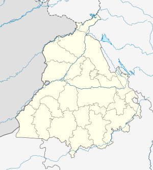
Phagwara Junction railway station is located on Ambala–Attari line in Kapurthala district in the Indian state of Punjab and serves the textile town of Phagwara.
The railway station
[edit]Phagwara railway station is at an elevation of 245 metres (804 ft) and was assigned the code PGW.[1]
History
[edit]The Scinde, Punjab & Delhi Railway completed the 483 km (300 mi)-long Amritsar–Ambala–Saharanpur–Ghaziabad line in 1870 connecting Multan (now in Pakistan) with Delhi.[2]
Electrification
[edit]The Phillaur–Phagwara sector was electrified in 2002–03, and the Phagwara–Jallandhar City–Amritsar sector in 2003–04.[3]
References
[edit]- ^ "Arrivals at Phagwara". indiarailinfo. Retrieved 20 February 2014.
- ^ "IR History: Early Days II (1870–1899)". IRFCA. Retrieved 20 February 2014.
- ^ "History of Electrification". IRFCA. Retrieved 20 February 2014.
External links
[edit]

